
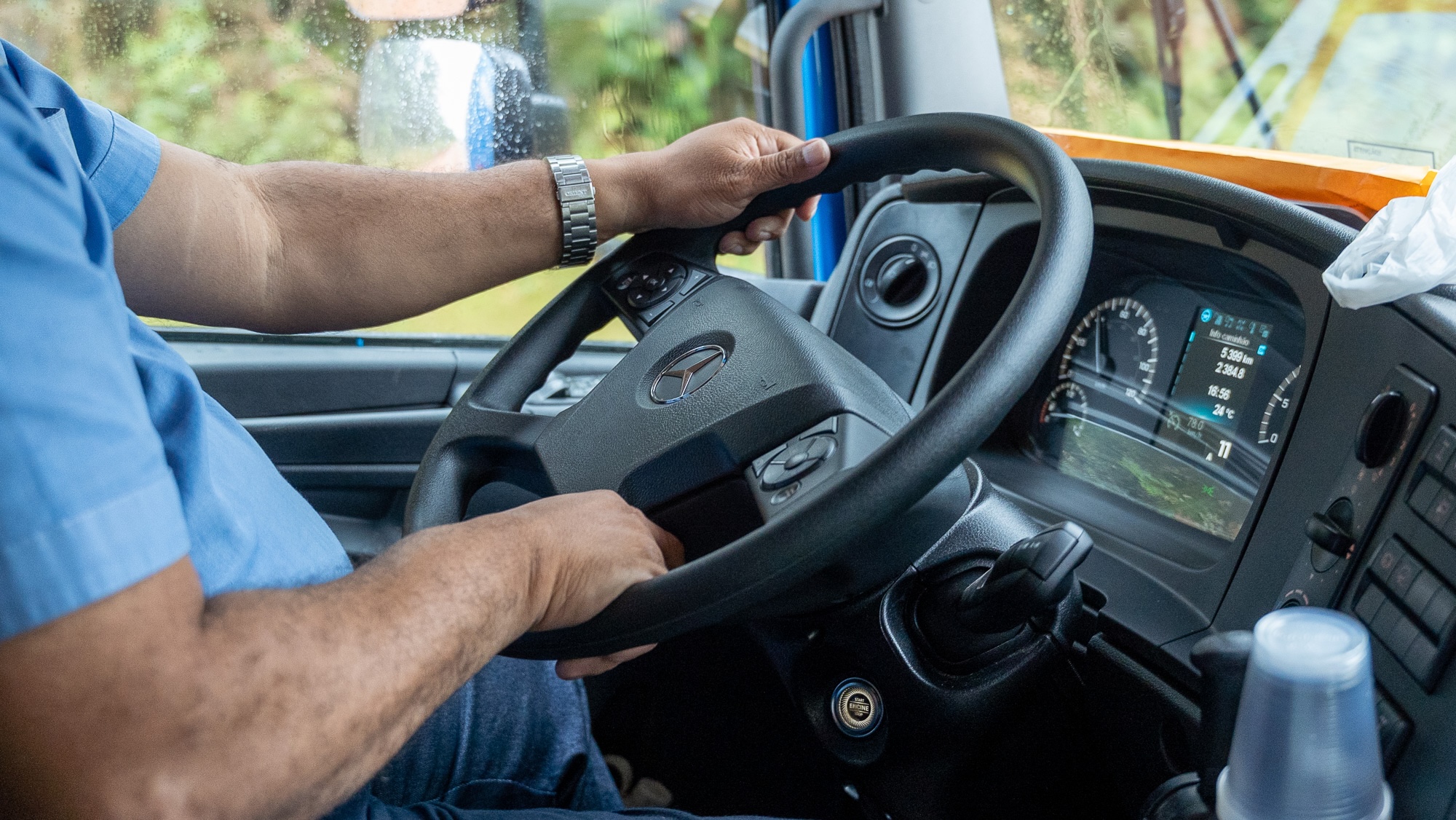
For much of his professional life, Carlos Santos’s office has been a semi-truck cab stranded in the heart of the Amazon rainforest. As a veteran truck driver on the BR-319—a notoriously hazardous, unpaved highway slicing through a critical section of the Brazilian biome—Santos knows all too well the unpredictable nature of the route. “You knew when you were going in,” he said, recalling weeks spent navigating the 540-mile stretch. “But you never knew when you’d come out the other side.”
It once took Santos 22 days to complete the crossing. An unexpected torrential downpour during the dry season turned the highway into a deep, impassable morass of mud that swallowed entire convoys of transport vehicles. Living conditions deteriorated into a test of jungle survival. Drivers had to ration food and water while watching time drag. At night, Santos would string a hammock inside his truck cabin, listening as jaguars, tapirs, and venomous snakes crossed the dirt track directly in front of him. Days were spent digging heavy vehicles out of deep ditches, bathing in nearby rivers, and waiting for heavy machinery to pull rigs out one by one.
When he finally returned home to Manaus, Santos would rest for a few days before immediately signing up for another haul down the 319. “I went back because I enjoy it,” he said. “It’s one hell of a challenge.”
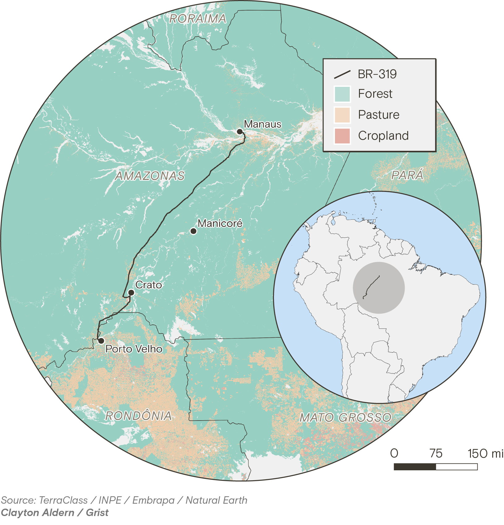
Beyond personal adventure, the arduous journeys are born of necessity. The BR-319 is the sole overland link connecting the vast state of Amazonas—an area twice the size of Texas with a population of 4.2 million people—to the rest of Brazil. Now, after decades of bitter court battles, intense regulatory challenges, and fierce resistance from environmental organizations, sections of the highway are being asphalted, and plans to pave the entire route are moving forward.
The Economic Cry for Connection Versus Global Climate Stakes
Asphalting the 319 represents a long-held, passionate demand for residents and business owners throughout the region, who argue that prolonged isolation severely stifles economic growth and drives up the cost of living. “Why should we be forgotten?” Santos asked, echoing a sentiment shared widely across the state. “Why doesn’t the state of Amazonas have the right to be connected to the rest of the country?”
Yet, the decision carries profound global consequences. Scientists warn that paving the highway will bridge previously isolated, pristine sections of the Amazon to its most heavily exploited and pressured frontiers, triggering an unprecedented deforestation boom. The Amazon biome currently stores an estimated 150 to 200 billion tons of carbon within its vegetation and soils, acting as an irreplaceable buffer against greenhouse gas emissions generated by fossil fuels and other human activities. When the forest is cleared and burned, that massive carbon reservoir is released directly into the atmosphere, accelerating global climate change. Meanwhile, Indigenous groups inhabiting the region warn that the infrastructure project threatens the very survival of their communities.
In May, prior to the paving efforts hitting full momentum, a reporting team joined Santos on his grueling route from Manaus to Porto Velho to examine firsthand how the highway and the surrounding ecosystem are already transforming.
The journey began at 3 a.m. at a distribution center on the outskirts of Manaus, a bustling capital home to more than two million residents. Despite its geographic isolation, Manaus has operated as a major manufacturing powerhouse since the 1960s, largely due to government tax incentives designed to attract industry. However, the vast majority of freight must still enter and leave the city via river transport or cargo aircraft. Proponents of paving the BR-319 argue that this heavy reliance on waterways and air freight drives up consumer prices, extends delivery timelines, and leaves the regional economy vulnerable to severe droughts that increasingly disrupt river navigation.
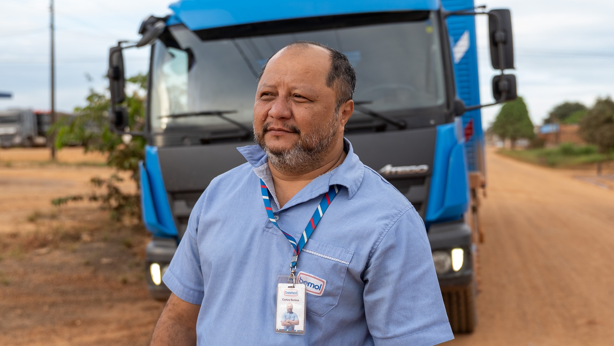
Santos, born and raised in Manaus, has been driving trucks professionally since he was 18 years old. Now 45, the affable driver sports a trimmed salt-and-pepper beard and a friendly demeanor, though years of pounding over the cratered roads of Amazonas have left him with chronic back pain.
Together, they departed in a bright blue semi-truck belonging to Bemol, a prominent regional retailer. Smaller and more nimble than the massive freight rigs that frequently capsize in the mud, the truck carried essential cargo including large kitchen appliances, home furniture, and pharmaceuticals destined for Porto Velho, the capital of Rondônia, located at the opposite end of the highway.
Santos has driven the 319 regularly since 2015, the year the route was partially cleared and reopened following decades of total abandonment. During the early years of its reopening, he recalled, vast pools of mud stretched across dozens of yards during the rainy season, and potholes rivaled the size of small craters. These memories were recounted as their truck boarded a ferry to cross the broad Rio Negro, sharing deck space with dozens of other vehicles. As the sun rose, the ferry passed the famous "Meeting of the Waters," where the dark, Coca-Cola-tinted Rio Negro flows side-by-side with the murky brown Solimões without immediately mixing. An hour later, they disembarked onto the highway, beginning a multi-day journey where arrival times remained completely dependent on unpredictable weather and road conditions. “You never know what to expect,” Santos noted.
The History of Roads and Destruction in the Amazon
In many ways, the modern history of deforestation in the Amazon is directly tied to the history of road construction. During the 1970s, Brazil’s military dictatorship pursued an aggressive national policy of cutting major highways through the jungle and encouraging colonization and settlement across the region. In the decades since, an expanse of rainforest roughly the size of Spain has been systematically cleared—with approximately 94 percent of that deforestation occurring within just three miles of a roadway. Experience shows that the mere announcement or legal possibility of a highway being built or paved is often sufficient to spark an immediate surge in land speculation and illegal clearing.
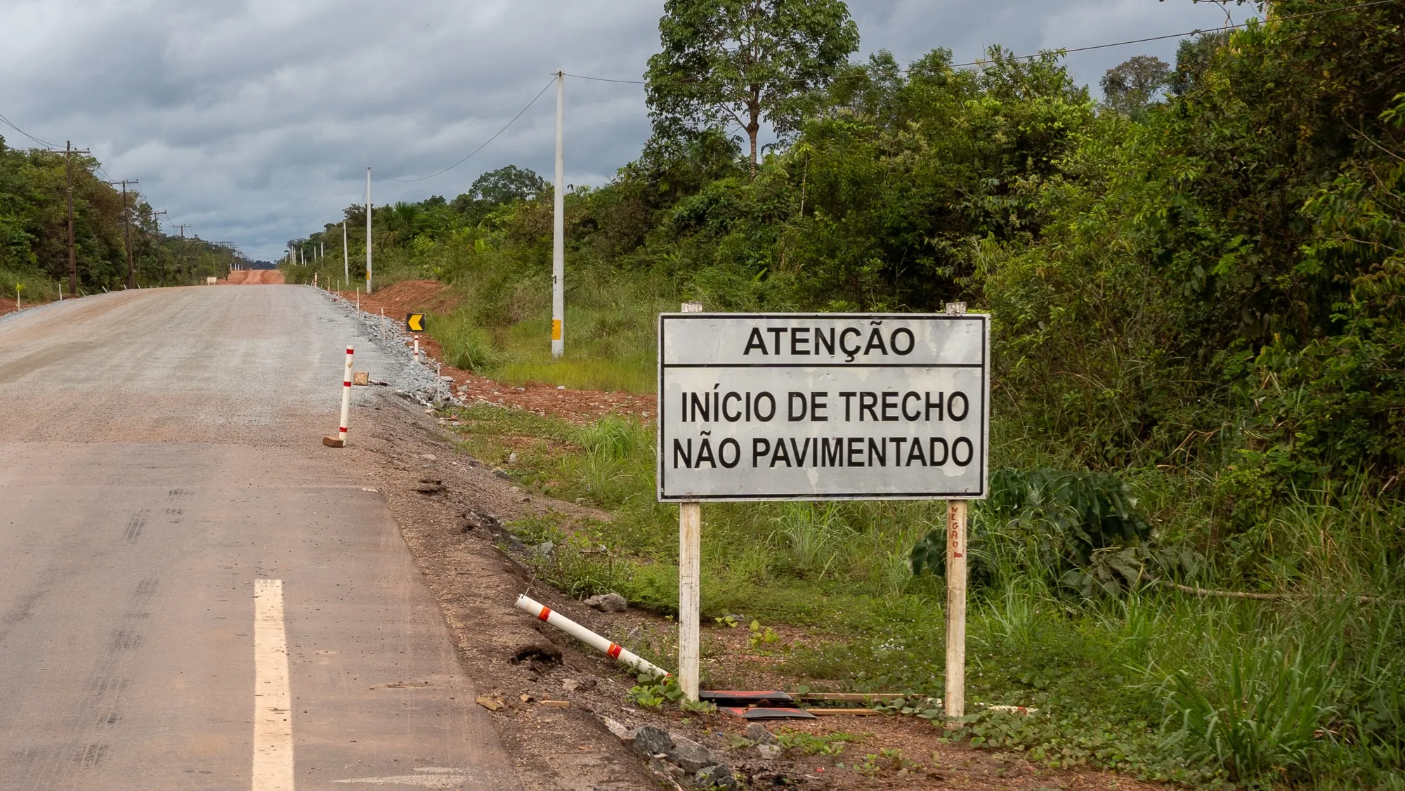
The BR-319 was originally paved when it first opened in 1976, but maintaining an asphalt surface in a low-lying, humid tropical environment proved economically and logistically unsustainable. Over time, the punishing combination of intense rainy and dry seasons eroded the pavement. Bus companies abandoned the route, commercial shipping ceased, and the encroaching forest reclaimed the concrete. By 1988, the road was virtually impassable, with only short paved stubs remaining at either end.
For nearly three decades, the middle of the highway was left to the jungle, utilized only by remote local communities and adventurous travelers. Trees grew thick over the center of the road, and wooden bridges rotted away. Then, in 2015, federal regulators issued limited licenses for basic cleanup and maintenance, though explicitly not for repaving. Maintenance crews set to work clearing overgrowth and repairing more than 50 wooden bridges along the corridor. While conditions remained precarious, regular traffic returned.
The political landscape shifted dramatically with the 2018 election of President Jair Bolsonaro, a far-right former army captain who campaigned on a platform favoring loggers, miners, and agribusiness while rolling back federal environmental protections. Bolsonaro’s vocal commitment to paving the BR-319 sparked an immediate 122 percent spike in deforestation within the surrounding highway corridor between 2020 and 2022—far outpacing the already elevated deforestation rates across the rest of the Amazon.
Although federal courts repeatedly blocked the paving project due to flaws and inconsistencies in the environmental licensing process, the political momentum proved difficult to halt. In 2025, Brazil’s pro-agribusiness Congress passed legislation allowing infrastructure work on existing roads to bypass standard environmental licensing requirements altogether. Despite attempts by President Luiz Inácio Lula da Silva to veto parts of the legislation, Congress overrode his vetoes. By May, the federal government had opened competitive bidding for paving contracts, with Transportation Minister George Santoro grandly announcing that the entire BR-319 would soon be under active construction.
Frontier Expansion and the Rise of Deforestation
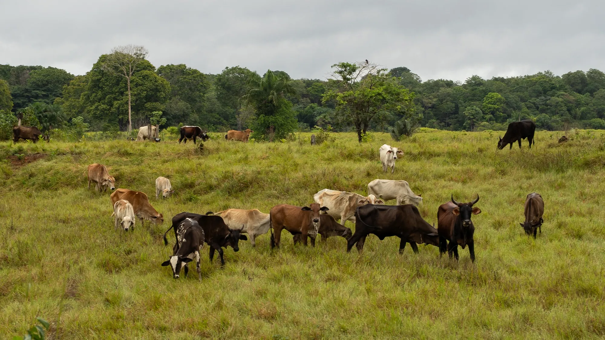
Driving south from the ferry terminal, the first 120 miles of the BR-319 consist of broken, potholed asphalt—the remnants of the original 1970s project. Passing through the district of Careiro, the landscape transitions dynamically between dense forest fragments, open cattle pastures, and scattered homesteads. “Houses used to be a rare sight,” Santos observed. “You’d see one here and another way off in the distance. Not anymore.”
This pattern characterizes the early stages of Amazonian deforestation. Initially, land speculators and illegal loggers clear public lands of valuable timber. Once the commercial wood is extracted, cattle ranchers move in, either settling the land themselves or hiring caretakers to manage livestock. The ultimate objective for many is securing formal land titles from the government—titles that skyrocket in value once a highway is fully paved. Because Brazil’s land regularization bureaucracy is slow, complex, and prone to irregularities, unauthorized occupation often serves as the opening step toward legal recognition, even when the initial forest clearing violates federal law.
The human and environmental toll of this unchecked expansion has been severe. For three months in 2023, Manaus was choked by a dense, toxic cloud of smoke, pushing the city’s air quality among the worst in the world. While regional politicians initially blamed forest fires in neighboring Pará state, subsequent scientific research utilizing satellite imagery and atmospheric modeling revealed that a significant portion of the smoke originated from local land-clearing blazes right at the gateway of the BR-319, including districts like Careiro.
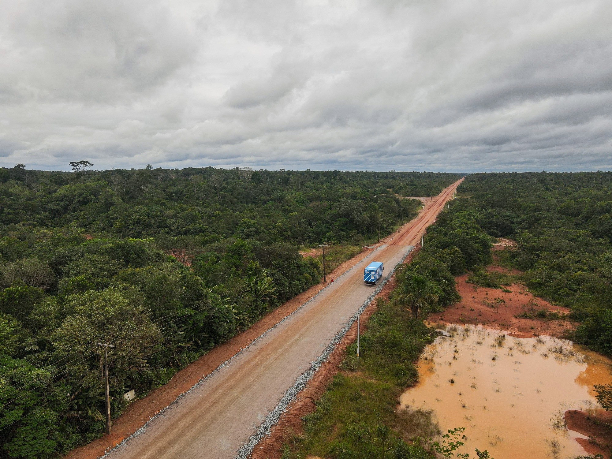
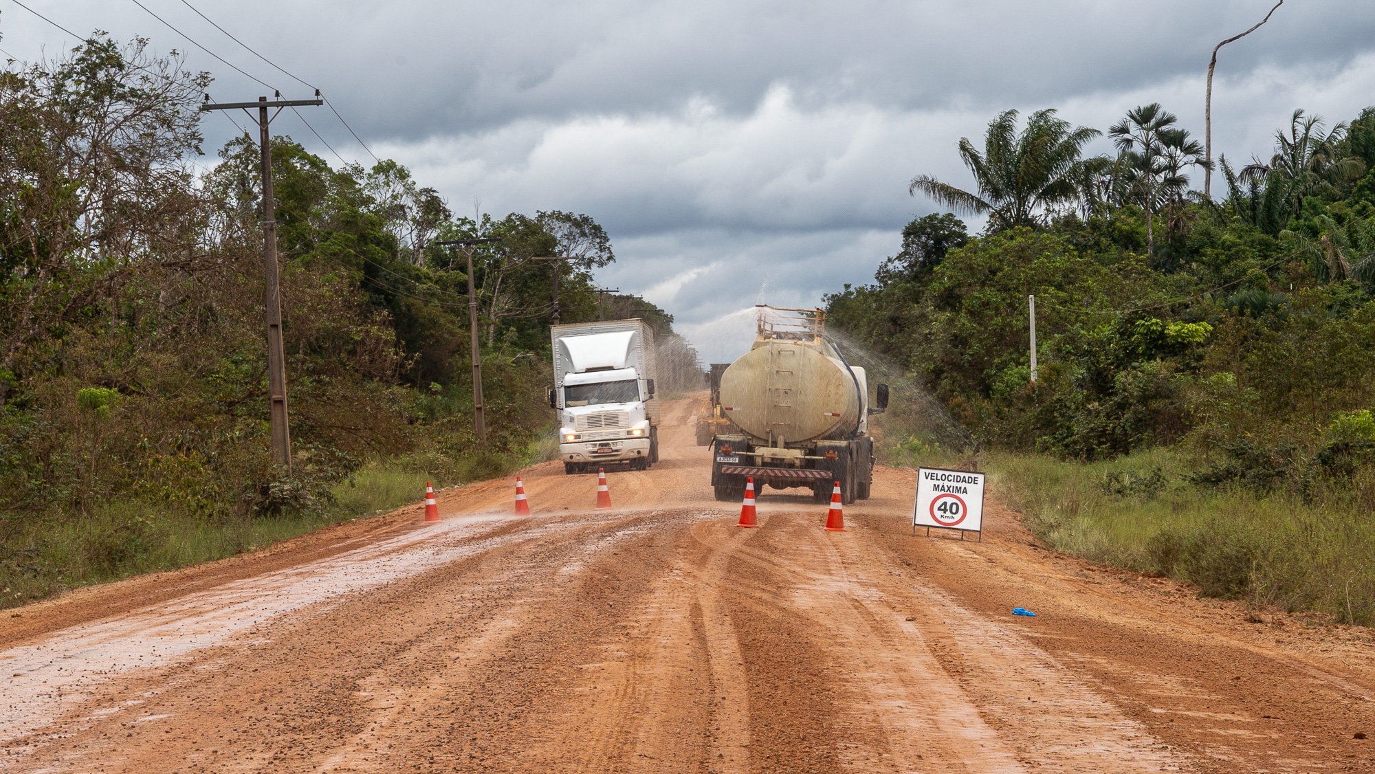
As the old asphalt finally ends, the landscape transitions from pasture back into dense wilderness before turning abruptly into a surface of reddish, iron-rich clay. This unpaved earth forms a rock-hard surface during dry spells, but transforms into an exceptionally slick sludge during the rainy season, causing heavy trucks to slide dangerously out of control. In dry conditions, continuous vehicle traffic sculpts the dirt into tight, rattling ridges that drivers colloquially call “cow ribs,” which shake transport trucks relentlessly.
Yet, compared to conditions just a few years prior, veteran drivers view the current state of the dirt road as an improvement. “For the veterans around here, the road is a cakewalk now,” Santos remarked, noting that maintenance operations have intensified significantly. Road crews now work daily across various sections to grade uneven terrain, pack down soil, and lay gravel. Low-lying areas prone to seasonal flooding have been elevated, and aging bridges reconstructed. Environmentalists, however, argue that these aggressive maintenance efforts frequently exceed the boundaries of the limited 2015 upkeep licenses.
Today, the highway accommodates a growing stream of heavy transport vehicles, including trucks hauling consumer electronics and retail goods from as far away as São Paulo, located 2,400 miles to the south.
Life Along the Frontier and the Promise of Governance
Traveling with Santos involves hearing a continuous catalog of mishaps and accidents witnessed along the route: washing machines tumbling into ravines from overturned flatbeds, or gallons of spilled milk slicking the road surface. Even now, encountering a capsized truck along the route is a regular occurrence.
Approximately eight hours into the drive, the journey reached the remote settlement of Iguapó-Açu. Home to roughly 75 families living in tin-roofed stilt houses, the village serves as the final rest stop for truck drivers before they enter the punishing 250-mile middle stretch of the BR-319, where the road cuts through continuous, unbroken forest. Residents sustain themselves through subsistence farming, small-scale fishing, and operating a sluggish municipal barge that ferries vehicles across a narrow river channel.
While waiting for the barge, local residents gathered on wooden porches to eat fresh fish stew. Raimunda de Sá Assunção, a 53-year-old resident who arrived in the settlement as a child, recalled when the road was originally paved, as well as the decades of subsequent decay when travel to the nearest hospital could take days. Although recent road improvements have cut travel times down to roughly two hours, Assunção remains deeply skeptical about grand promises of complete asphalting. “My hair’s turned white, and nothing’s happened. All they do is plug holes,” she said. “I’宁ll believe it when I see it.”
A few miles north of Iguapó-Açu, President Lula staged a high-profile photo-op with road construction crews in late May, painting an optimistic picture of the project’s future. “हम will set an example of how to build a road,” Lula declared, promising that the finished highway would become “the most beautiful and most preserved road in the world.”
Lula’s 2022 presidential victory relied heavily on a broad anti-Bolsonaro coalition that included Marina Silva, a globally respected environmentalist and politician. To secure her crucial backing, Lula placed environmental preservation at the core of his platform, committing to halt deforestation across Brazil by 2030.
While his administration has successfully driven overall deforestation rates down from the peaks seen during the Bolsonaro years, the government has struggled to block a wave of pro-development legislation pushed through by Congress, including the environmental licensing rollback that cleared the path for the BR-319 project. Facing intense political pressure ahead of elections, Lula ultimately threw his support behind paving the highway to secure regional votes. Meanwhile, Marina Silva—long cast by regional politicians as an obstacle to the road—resigned from her cabinet post to run for the Senate, having consistently argued not against the road itself, but for strict, mandatory environmental safeguards.
During closed-door meetings with environmental organizations, federal officials pledged that a portion of the highway’s 1.5 billion Brazilian reals ($300 million) construction budget would fund a comprehensive environmental governance plan. This plan includes establishing protected conservation areas, wildlife overpasses, and intensified environmental monitoring within a 60-mile buffer zone along the corridor. Critics, however, point out that these vital preventive measures remain largely in the discussion phase even as heavy asphalting is already underway.
“The plan being drawn up needs to be translated into documents with feasible, credible targets,” said Suely Araújo, public policy coordinator at the Climate Observatory, a Brazilian civil society network. “You need structural measures that are actually implemented. Not just promised.”
On September 8, President Lula formally announced the creation of four new protected areas surrounding the BR-319, encompassing roughly 2,600 square miles—an area significantly smaller than the nearly 14,000 square miles previously discussed in private meetings with civil society groups.
“On one side were people who thought it was off-limits to undertake a project on a road that had already been built, connecting two state capitals,” Lula said during an official ceremony. “On the other were people who thought we should do it haphazardly… turning it into a way for a few people to get rich by buying and selling land. We insisted that it was possible… We found a way to demarcate whatever needed to be demarcated.”
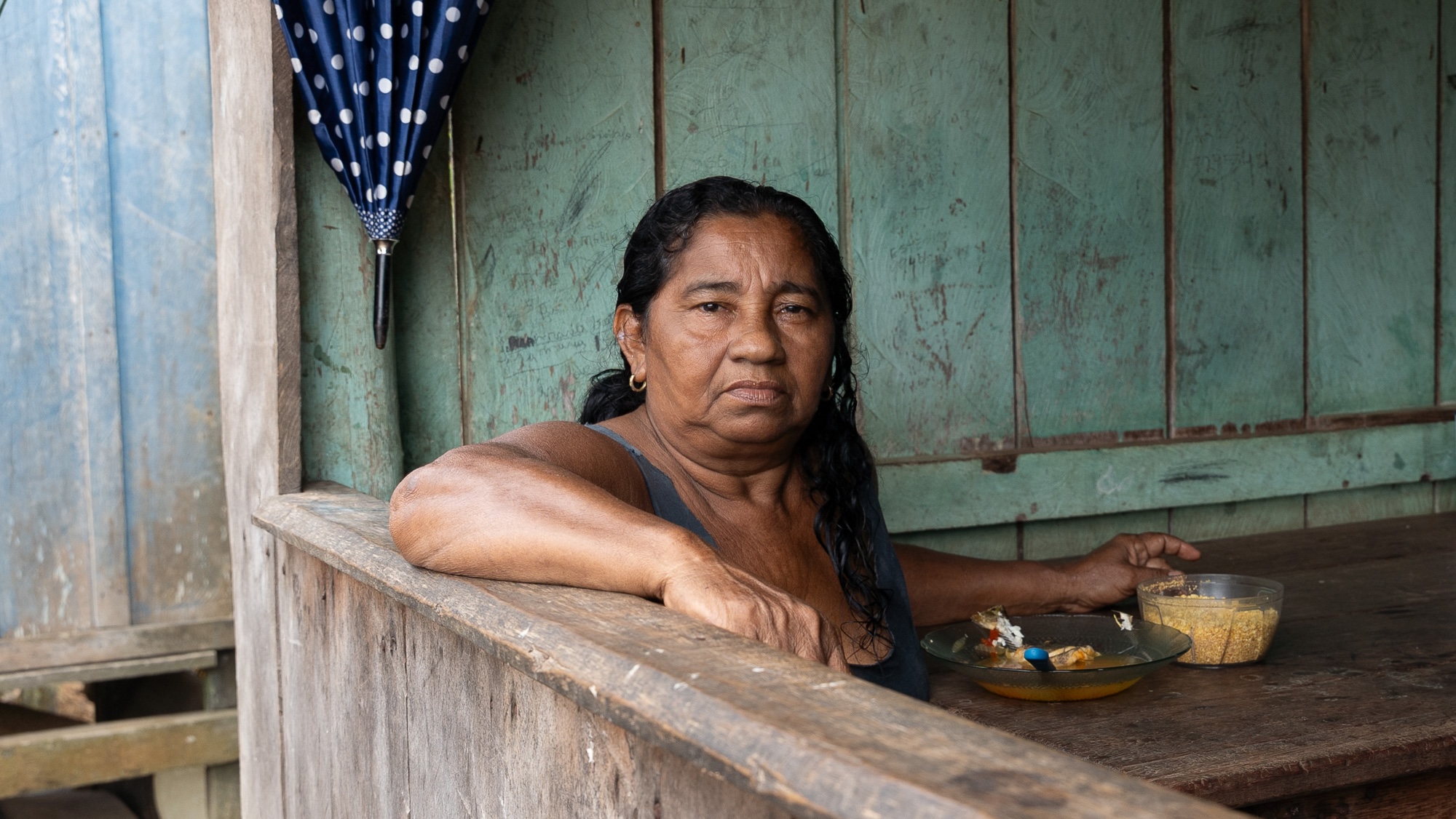
Despite these measures, the vast majority of land flanking the BR-319 remains undesignated public property, making it prime territory for illegal land-grabbers. Observers note that while designating protected areas serves as an important deterrent against deforestation, many of these parks and reserves exist primarily on paper. Enforcement agencies like IBAMA, Brazil’s federal environmental enforcement bureau, remain chronically understaffed, and regions along the highway lack permanent police checkpoints or dedicated monitoring bases.
The "Fishbone" Phenomenon and Climate Tipping Points
Experts frequently warn of the “fishbone phenomenon,” a well-documented deforestation pattern observed across the Amazon from aerial and satellite views. In this configuration, main highways function as the central spine, while a dense network of unauthorized side roads cut by illegal loggers, land speculators, and wildcat miners branch out like ribs into the surrounding jungle. It is along these clandestine secondary routes that the vast majority of environmental destruction occurs.
Although the BR-319 is only in the early stages of this cycle, satellite data indicates that the highway already features a network of illegal side roads nearly six times longer than the main thoroughfare itself. Following these branching tracks on satellite imagery invariably reveals large, freshly cleared agricultural patches carved deep into the pristine rainforest.
Phillip Fearnside, a prominent senior biologist at the National Institute of Amazonian Research (INPA), cautioned against the sheer speed at which large swaths of forest can be decimated once access is established. Researchers utilizing advanced computer modeling have simulated the long-term environmental impacts of paving the BR-319 and the subsequent proliferation of secondary roads. One comprehensive study led by Britaldo Soares-Filho at the Federal University of Minas Gerais projected that paving the corridor would induce sufficient deforestation to release 8 billion tons of carbon dioxide into the atmosphere by 2050—four times the emissions expected if the road were simply maintained as an unpaved route. Another study predicted that deforestation rates within the region would surge by 60 percent by the year 2100 under a fully paved scenario.
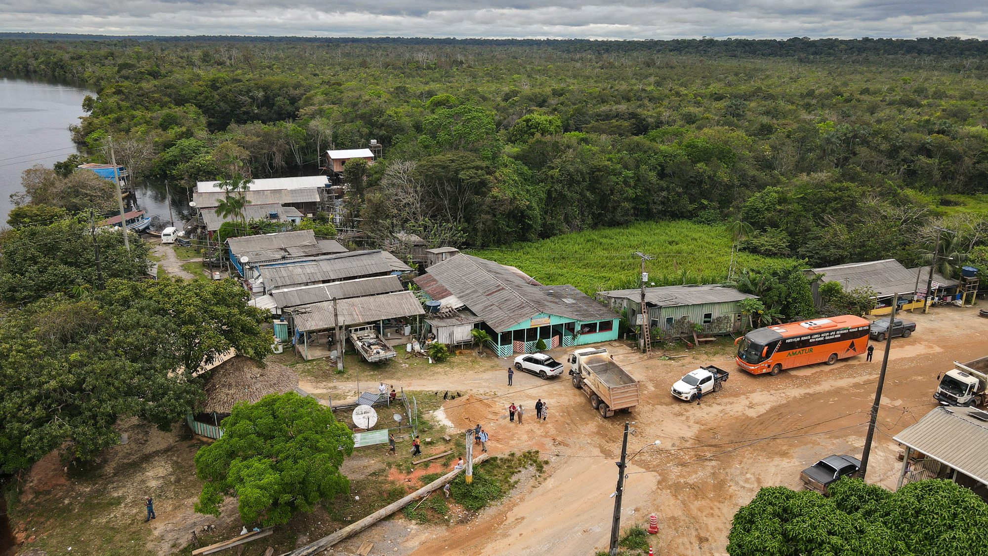
Fearnside argues that the ecological fallout would reach far beyond the proposed 60-mile monitoring buffer zone. By physically connecting the largely untouched central Amazon—described by scientists as the last great expanse of continuous rainforest—to aggressive deforestation hotspots in the southern frontier, the project risks pushing the entire biome past a critical climate tipping point.
The human cost is similarly immediate. Indigenous communities whose traditional territories fall within the highway’s sphere of influence are already experiencing severe disruptions. Numerous reports document illegal side roads encroaching onto protected Indigenous lands. The Mura people of the Lago Capanã Grande region have faced escalating threats from land-grabbers since traffic conditions improved in 2020. Evidence indicates that toxic herbicides containing 2,4-D—a potent chemical component once used in Agent Orange—were illegally applied to clear forests in areas utilized by the Mura to harvest wild Brazil nuts. The chemical runoff subsequently contaminated local river systems, causing acute illness among community residents.
In total, approximately 69 Indigenous territories lie within the direct zone of influence of the BR-319, home to at least 13 distinct ethnic groups comprising more than 18,000 individuals, including groups living in voluntary isolation. Although Brazilian law mandates prior, free, and informed consultation with Indigenous populations regarding major infrastructure projects that impact their traditional lands, local advocacy groups report that no such meaningful dialogue has taken place.
“Consultation must happen before any decision is made, with real dialogue and the possibility of influence, including the right to say ‘no.’ What is happening is the opposite,” Mariazinha Baré, a coordinator for the Indigenous organization APIAN, told the Brazilian outlet Nexo. “BR-319 is not just infrastructure; it is an instrument of death that threatens the existence of Indigenous peoples and weakens the Amazon.”
Reaching the End of the Line
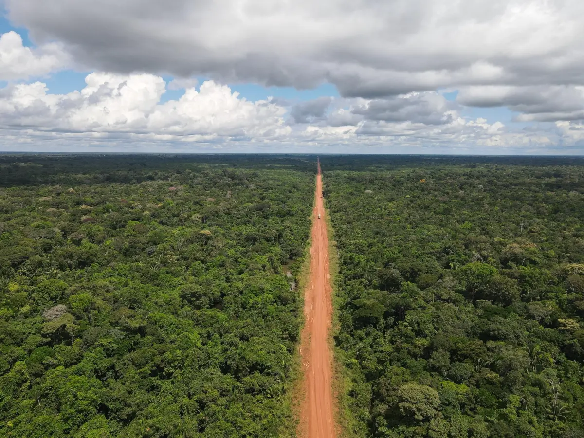
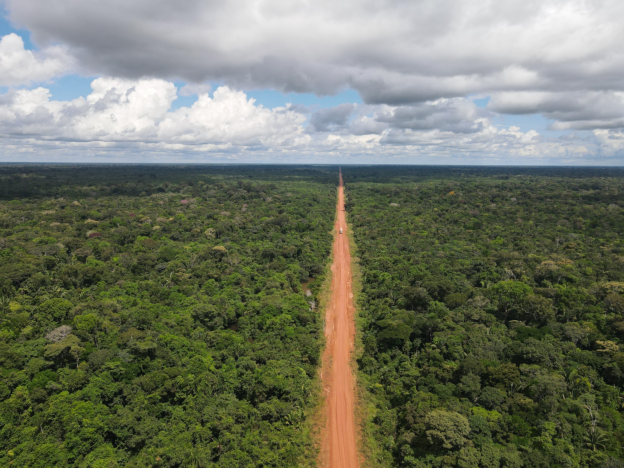
Beyond Iguapó-Açu, the highway enters its wildest and most remote stretch. Overhead drone flights reveal an unbroken, dense green carpet of ancient forest stretching to every horizon, bisected only by the striking red scar of the dirt road.
Because mobile phone service is completely absent along this stretch, drivers traveling in opposite directions frequently stop to exchange vital intelligence regarding road conditions, weather patterns, and mud hazards. Shortly after resuming the drive, a passing trucker warned of impending rain.
What began as a light drizzle quickly escalated into a torrential downpour. “While it’s raining, it’s best to push on,” Santos advised, explaining that the hours immediately following a heavy storm—when the clay surface begins to dry out into a treacherous, frictionless glaze—present the greatest danger to transport vehicles. With darkness falling and roughly 100 miles remaining before reaching the frontier town of Realidade, the truck crawled forward through rapidly forming pools of sludge.
Hours later, the headlights illuminated a flatbed truck carrying heavy electrical generators that had slipped off the soft shoulder, leaning precariously over a deep drainage ditch. “Welcome to the BR-319!” Santos laughed, maintaining his composure.
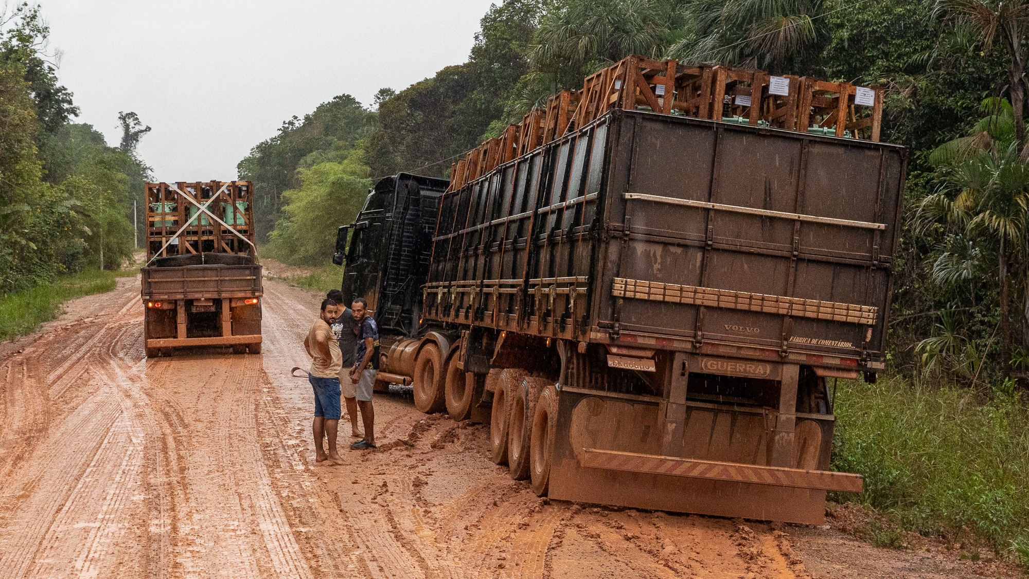
As night deepened, forward visibility was limited entirely to the reach of the truck’s headlights as the relentless rain persisted, occasionally reducing their speed to a mere five miles per hour. Creaking wooden bridges groaned beneath the heavy tires before the lights of Realidade finally emerged out of the dark. At 11 p.m.—twenty grueling hours after departing Manaus—the truck pulled into the parking lot of a brightly lit motel named La Kazita.
As the largest settlement along the unpaved corridor, Realidade exemplifies the classic Amazonian boomtown. Its population has surged from roughly 800 residents in 2010 to an estimated 7,000 today, with its entire local economy tied directly to the fluctuations of the highway. Many of the original inhabitants were construction workers who built the road in the 1970s; when the route closed in 1988, the settlement temporarily transformed into a ghost town. A new wave of landless farmers arrived in 2004 under federal settlement programs, followed by a steady influx of speculative land-grabbers, illegal loggers, and cattle ranchers.
Today, Realidade lacks a permanent police presence and maintains only a small medical post, contrasted with a proliferation of agricultural and cattle-ranching supply stores. At La Kazita, the motel manager recounted how loggers emerging from weeks of felling trees deep in the forest frequently arrive flush with cash to spend in nearby mining towns like Humaitá. Data compiled by Simex, a satellite-based forest monitoring system, indicates that approximately 16 square miles of land were illegally cleared within the municipality encompassing Realidade between 2021 and 2024.
“All the money flowing through the region is rooted in illegal logging and land grabbing,” said Lucas Ferrante, a researcher at the University of São Paulo who has extensively studied the area.
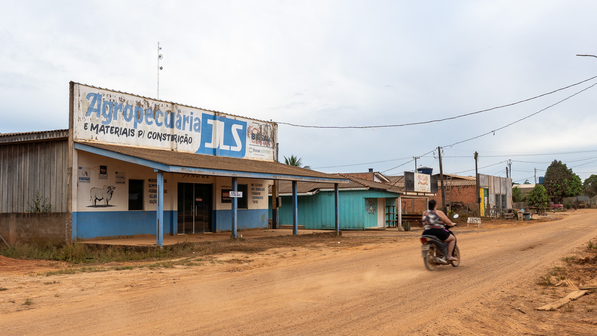
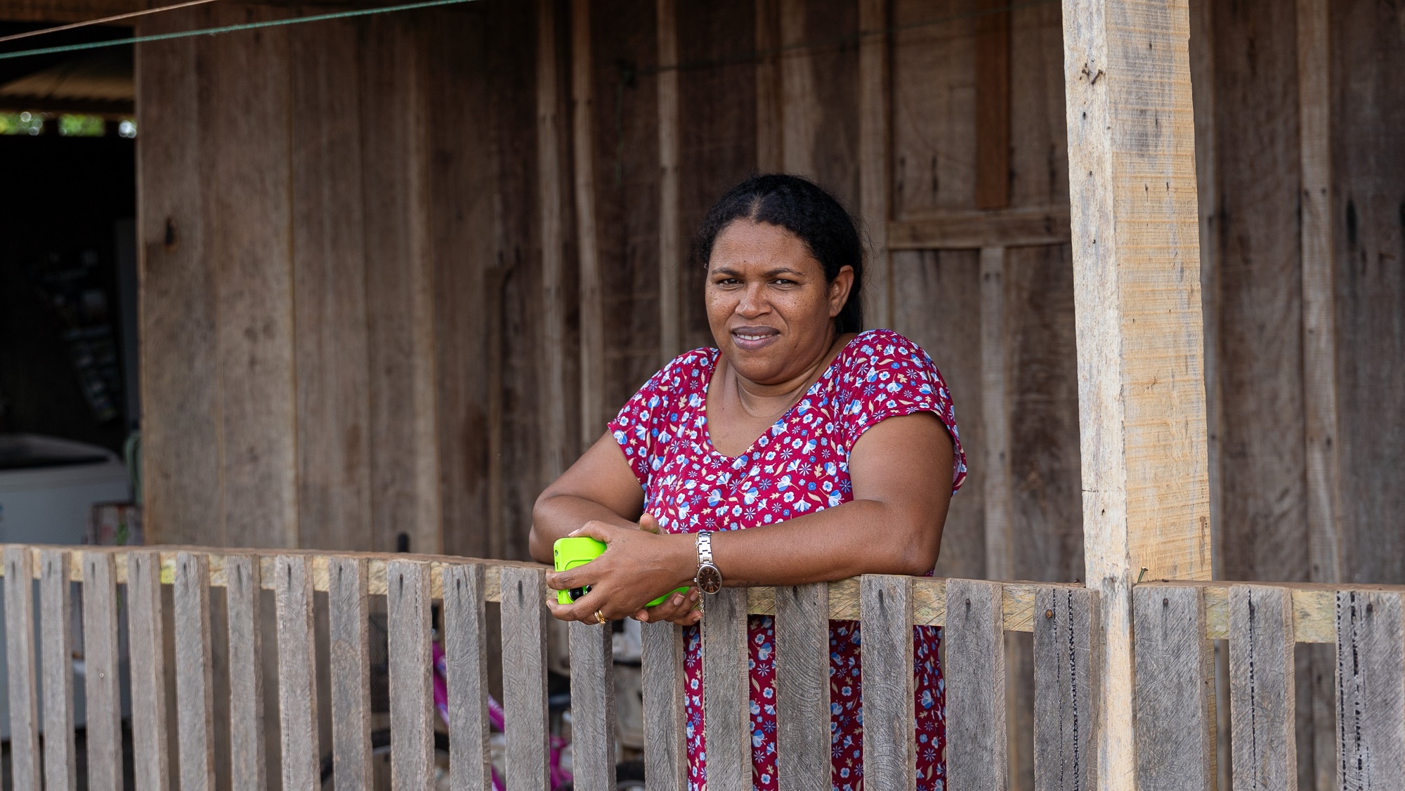
The surrounding landscape reflects this intense human pressure. Sawmills line segments of the highway, and native forest gives way to sprawling cattle pastures. Eliane Jesus Pereira, 33, lives with her family in a modest wooden home on the edge of a large ranch north of Realidade, selling buffalo-milk cheese while her husband tends livestock. Moving to the property in 2021 from Realidade, Pereira noted that basic road maintenance has at least improved local mobility: “Sometimes my daughter couldn’t go to school because the bus got stuck in the mud. Now it’s better.”
The Complex Calculus of Regional Development
While scientists agree that paving the BR-319 without strict governance will accelerate widespread environmental degradation, the broader economic realities facing Amazonas cannot be easily dismissed. A 2025 survey conducted by the Instituto de Pesquisa do Norte indicated that roughly 90 percent of residents in Amazonas support asphalting the highway. The state currently registers one of the lowest GDP per capita figures in the country and lags significantly behind national averages across key developmental metrics, including educational access and healthcare infrastructure.
“We have the sense that the region is subordinate to Brazil, like an invaded territory, a colony,” said Augusto Rocha, an engineering professor and logistics specialist at the Federal University of Amazonas. “Infrastructure is a way of reducing this inequality.” While supporting the establishment of the road, Rocha emphasizes that robust environmental controls are essential to prevent unchecked deforestation.
“We don’t deny the importance of the road,” Suely Araújo reiterated. “The problem is building it without the necessary social and environmental conditions in place.”
As the truck finally crossed back onto paved asphalt approaching Porto Velho, the tension of the unpaved terrain lifted. Caked in dried red mud from bumper to bumper, the vehicle accelerated smoothly for the first time in two days. Yet, just minutes after returning to the paved surface, the harsh realities of the frontier reappeared: first a bright green snake, and miles later an anteater, lay dead on the asphalt—stark reminders of the high ecological stakes accompanying connectivity in the Amazon.